Close-ups:
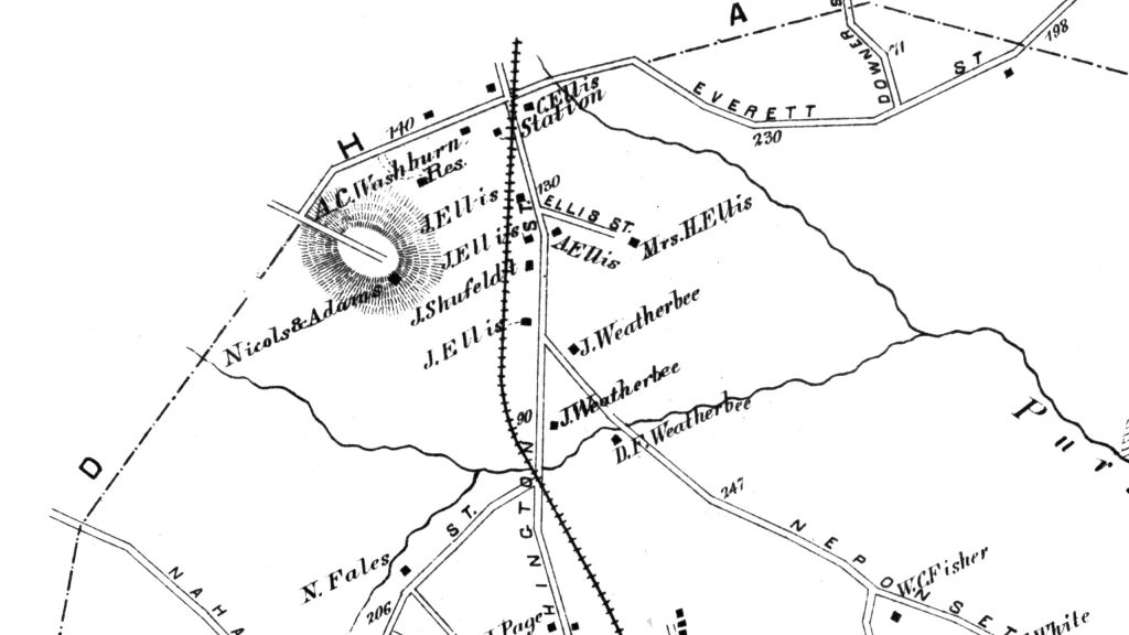
Below we see the Northern section of town. At the top of the map, close to the Westwood town line, was the Ellis Railroad Station, which was located near the corner of Everett and Washington Street. The area around this station, where many members of the Ellis family lived, was known as "Ellis", and in fact, mail sent to people living in this little village was often addressed 'Ellis" rather than "Norwood".
The land on the left side of the map between Clapboardtree St, Washington St, and Prospect St, where Moderna is currently constructing its World Headquarters was uninhabited in 1876 except for the Nichols and Adams farm. This farmland later passed through several hands, including Henry O. Peabody, W. Cameron Forbes, Harvard University, United Fruit Company, and Polaroid, before being subdivided for use by multiple different businesses (Mercer Investments, Universal Techincal Institute, Covidien) in the 1990's as Polaroid was winding down.
On September 23, 2016, Moderna announced that it had signed a long-term lease (15 years plus renewal options) to build a state-of-the-art Good Manufacturing Practices (GMP) clinical manufacturing facility on the site. The state-of-the-art manufacturing facility opened on July 21, 2018, The digitally-enabled and environmentally sustainable 200,000 square foot clinical development manufacturing plant was built to advance Moderna's research pipeline of mRNA-based medicines. In April of 2021, at the height of the Covid-19 pandemic, the company announced an expansion that increased the plant to approximately 650,000 square feet. This was done through a combination of renovation of the existing space and the acquisition of a 240,000 square foot building previously occupied by UTI.
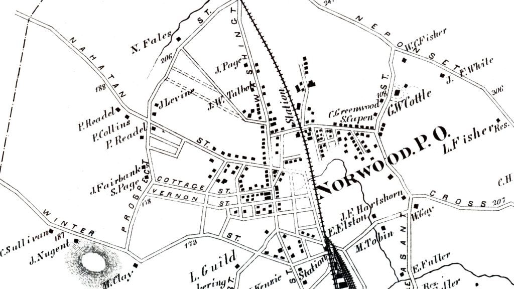
The area outside of Norwood Center, known then as "the Hook", was relatively undeveloped in 1876 compared to today.
On the west side of Washington St (left side of the map), many streets did not exist yet, and some of those that did were shorter than they are today.
Nahatan St. ran from Westwood to Broadway, where it ended at the railroad tracks. Railroad Avenue only ran from Washington St to Pleasant St.
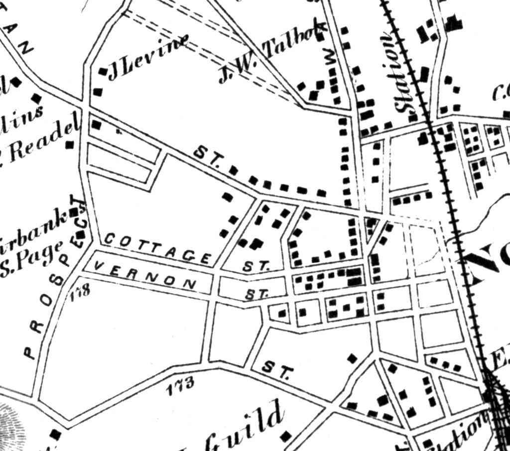
West of Prospect St. on both sides of Nahatan St. was completely undeveloped. Prospect Park, a tract of land that served as the site of picnics , band concerts, baseball games and other public events before the Town Common was created, can be seen bounded by Vernon, Prospect and Winter streets.
"Cork City", the area of Railroad Ave east of Washington street heavily populated by Irsh workers, was the major population center on that side of the tracks due to Lyman Smith's tannery just up the road at the corner of Railroad Ave and Lenox St. (then called Foundry St). Note the sparse population on Neponset, Pleasant, and Cross Streets.
Here's a closeup of Norwood Center and the "Christian Hill" neighborhood.
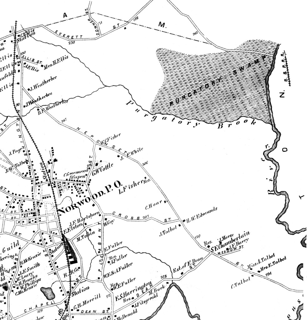
Note the original path of Washington Street below, as it crossed over Chapel Street close to Winslow train station. The station was abolished in 1891 after multiple accidents, and Washington St was rerouted to its current path with the creation of "Subway Hill".
Also, note that there were no side streets yet in South Norwood from Dean St to Short St on Morse Hill.
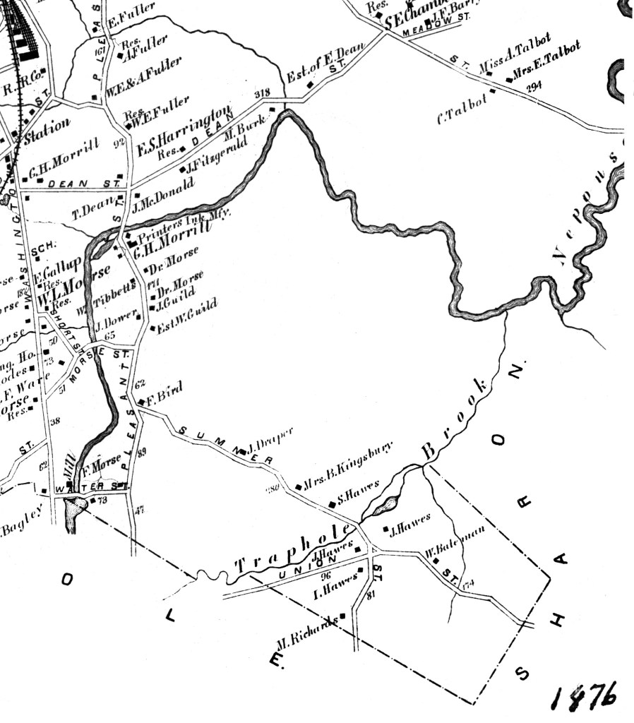
Purgatory swamp, Purgatory Brook and the Neponset River dominated the east side of town in 1876 and only a handful of families lived east of Neponset St
The other large undeveloped area of town in 1876 was situated between Pleasant St. and Neponset St. on both sides of Dean St.
The construction of US Route 1 in the 1930's and Interstate 95 in the 1950's led to multiple housing developments, including Cleveland Park between Pleasant Street and Route 1.


No comments:
Post a Comment